Map Area Measurement Platform
Project Overview
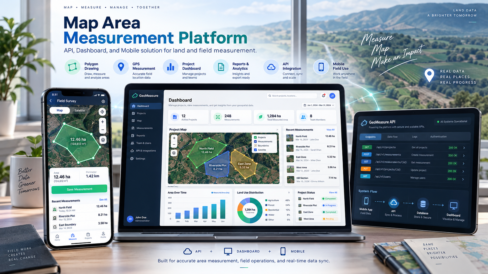
A backend and geospatial platform supporting mobile applications that allow users to draw polygons on a map and calculate land or field area measurements. The platform receives coordinate data from mobile clients, processes geometry, calculates area, stores measurement records, and provides history retrieval — all through a structured REST API designed for mobile integration.
Problem
Mobile users working in the field need to define polygon boundaries on a map, calculate the area enclosed, and store measurements for later reference. The backend must reliably receive polygon coordinate sequences, validate the geometry, calculate area accurately, persist the measurement, and allow users to retrieve their measurement history. Coordinate data from mobile devices can vary in precision and sequence, so the backend must handle these variations consistently.
My Role
I was responsible for the backend and API architecture, geospatial data model design, measurement record workflows, coordinate storage design, and the mobile-friendly REST API layer.
Technical Approach
- Polygon coordinate submission endpoint accepting ordered coordinate sequences from mobile clients
- Geometry validation to confirm the submitted polygon is closed, non-self-intersecting, and has sufficient vertices
- Area calculation workflow applied to validated polygon geometry
- Measurement record storage associating the calculated area, coordinate data, and metadata with the authenticated user
- User measurement history retrieval with filtering and pagination support
- Mobile-friendly REST API design with consistent response structures and clear error codes
- Authentication to associate measurements with individual user accounts
- Structured error responses so mobile clients can surface meaningful feedback to users
Core Architecture
The API is structured around measurement as the core domain entity. A measurement request carries a coordinate sequence; the backend validates, calculates, and persists it as an atomic operation. Coordinate sequences are stored alongside the calculated result so historical measurements can be re-inspected or re-rendered on the mobile map. The API response design follows a consistent envelope pattern so the mobile client has predictable parsing logic regardless of the operation outcome.
Key Engineering Challenge
The core engineering challenge is handling polygon geometry and measurement data consistently between mobile and backend systems. Mobile clients submit coordinates in varying precision formats and sequence orders. The backend must normalize these inputs, confirm geometric validity, and calculate area in a way that produces stable, repeatable results — particularly for irregular field boundaries where coordinate density varies significantly across different user drawing styles.
Technologies
Outcome / What the System Enables
The platform provides a reliable backend foundation for mobile field measurement applications. Users can draw polygons, receive instant area calculations, and retrieve their full measurement history. The consistent REST API design keeps the mobile integration straightforward, and the geometry validation layer prevents malformed coordinate data from reaching the storage layer.